
Are you planning your trip to Peru and wondering where the Sacred Valley is located?
You’ve probably heard about this wonderful place in Peru full of ancient Inca ruins and facinanting scenery, but you’re still not sure exactly where it is, or how to get there. In this article, we’ll explain exactly where the Sacred Valley is in Peru, and why it’s a must see destination. Read on to plan your visit like a pro.
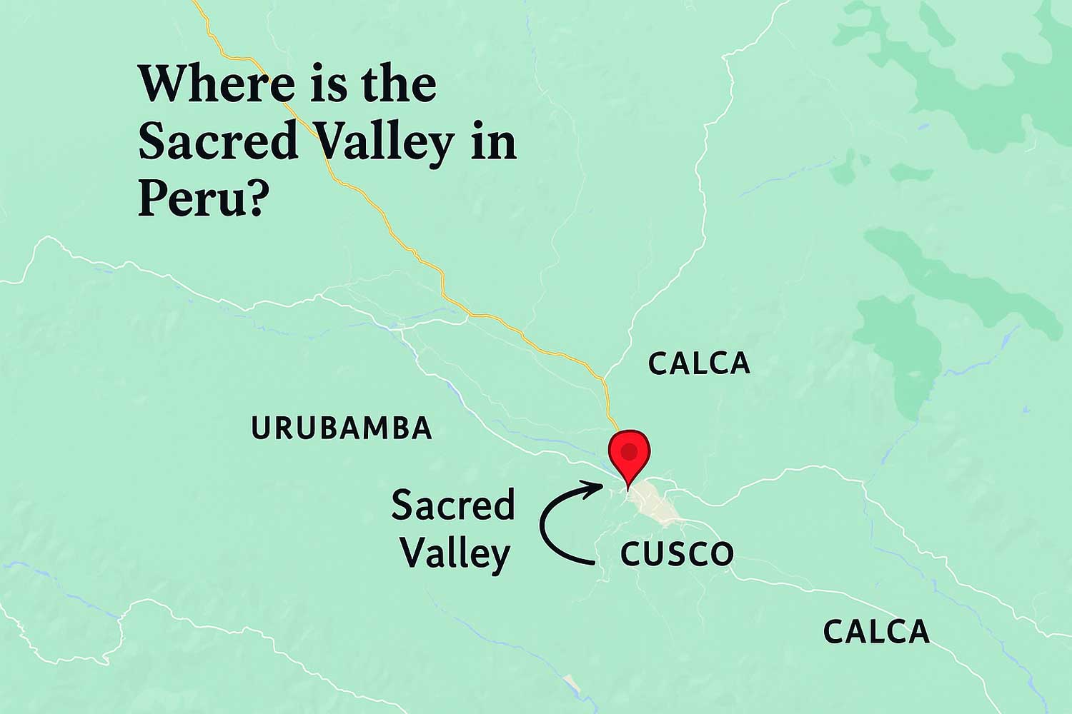
Where Is the Sacred Valley in Peru?
The Sacred Valley, or El Valle Sagrado de los Incas, is located in the highlands of southern Peru, at approximately 30 kilometers (18 miles) northwest of the city of Cusco.
Geographically, it is located at an altitude between 2,000 and 3,000 meters (6,500 to 9,800 feet) above sea level, making it lower area than Cusco and the best place for acclimatizing to the high elevation.
Geographical Location of the Sacred Valley, Peru
The Sacred Valley is located in the highlands of southern Peru, within the Cusco Region, specifically in the provinces of Calca and Urubamba. It stretches along the Urubamba River (also known as the Vilcanota River or Wilcamayu), which runs through deep canyons and lush valleys surrounded by the snow-capped peaks of the Andes.
Latitude: Between -13.2° and -13.4° South
Longitude: Between -72.0° to -72.3° West
Elevation: Ranges between 2,000 m and 2,900 m.
What Provinces Make Up the Sacred Valley?
The Sacred Valley covers parts of three provinces in the Cusco Region:
- Urubamba Province
- Calca Province
- Cusco Province (some areas)
The most visited villages in the Sacred Valley include:
Pisac: 2,972 m (9,751 ft)
Urubamba: 2,871 m (9,419 ft)
Ollantaytambo: 2,792 m (9,160 ft)
Chinchero: 3,762 m (12,343 ft)
How Far is the Sacred Valley from Cusco?
In fact, it depends on where you’re headed – Pisac, Urubamba or Ollantaytambo – you could get there in less than an hour or two. But what makes the distance complicated is that the Sacred Valley is not just one place, but a collection of impressive tQuechua towns and ruins.
Pisac: 1 hour by car from Cusco (33 km / 20 mi)
Urubamba: 1.5 hours (57 km / 35 mi)
Ollantaytambo: 2 hours (72 km / 45 mi)
Map Overview:
From Cusco to the Sacred Valley: Approximately 1 hour by car (Pisac is closer; Ollantaytambo is farther).
Sacred Valley to Machu Picchu: From Ollantaytambo, you can take the train to Aguas Calientes (Machu Picchu Pueblo).
How to get to the Sacred Valley
From Cusco by taxi:
Most travelers book a private taxi or tour from the city of Cusco to the Sacred Valley.
Travel time depends on the destination, but ranges from 45 minutes to an hour and a half.
By public transport:
You can take shared minivans (called colectivos) on Pavitos street in Cuzco.
Cost: Between 3 and 5 USD per person.
Is the Sacred Valley at High Altitude?
Yes, but the altitude is lower than Cusco.
Cusco altitude: 3,399 m (11,152 ft)
Sacred Valley average altitude: Around 2,800 m (9,186 ft)
Why is this important?
Many travelers use the Sacred Valley to acclimate to the altitude before exploring Cusco. The lower elevation helps reduce the risk of altitude sickness.
Conclusions:
Finally, if you are wondering where the Sacred Valley is, the answer is simple: The Sacred Valley of the Incas is located just northwest of Cusco, in the southern highlands of Peru. This beautiful region stretches from Pisac to Ollantaytambo, following the winding Urubamba River, and serves as the gateway to Machu Picchu. More than a place on the map, the Sacred Valley is a area full of history, Inca ruins, local villages and breathtaking scenery. It is only 1-2 hours from Cusco by car and, because of its lower altitude, is often the perfect starting point for travelers beginning their adventure.


